
The path from Wythburn Church to the summit of Helvellyn is an old and well trodden route though it is perhaps now not as popular as the wide path via Grisedale Tarn or the more exciting but over publicised Striding Edge. In terms of variety and the beauty of the views though, this route to England’s third highest mountain is hard to beat especially if an old and little used shepherds’ track is followed. It is detailed in the Wainwright Guide The Eastern Fells though few people used it then and probably even fewer do today.
Beginning at Wythburn Church the path leads steeply up between tall pine trees with the river on the left; to cross a forestry road before leaving the sheltering trees for the open fellside above. The way ahead is never in doubt and soon enters a steep sided valley where the gradient of the path eases before climbing steeply up the right slope below crags. Soon the easy grassy slopes above are reached and the path again turns back around to the left with spectacular views northward along Thirlmere to where the prominent peak of Skiddaw stands in apparent isolation.
Soon after the steep drop offs to the left are passed a faint path leaves the main one in this direction and soon crosses a stream descending the western slopes of the mountain. The walker following this soon has the mountains to his or her self and is led roughly northward across easy slopes of tussock grass. The path fades in and out and it is apparent that it is rarely used, soon passing a large rock that makes a comfortable rest stop with views towards the hills around Wasdale and Buttermere away to the west. This is a tranquil place on a warm day and it is worth lingering before rejoining the rest of humanity on the summit.
The way up is found by continuing around the slope below small crags and once past them heading up the slope to the right over steep but not difficult terrain. As the path is faint and practically non existent in the latter stages, this route can not be recommended in poor weather but on a day of good visibility it is a joy to follow. Presently the main path is reached and followed left up to the summit at 3116ft or 950m above sea level – the third highest point in the Lake District.
After enjoying the views I returned by the normal path – remember to branch down to the right at the fork before Nethermost Pike or you will end up at Grisedale Tarn and wonder why you never passed it on the way up. In total it’s a climb of 2550ft or just under 800m and a distance of just over 5miles/8km in total.
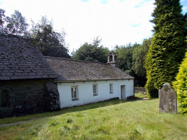
Wythburn Church at the start of the route
Emerging above the forest with views of Thirlmere

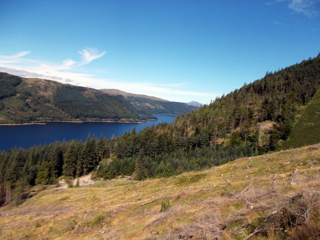
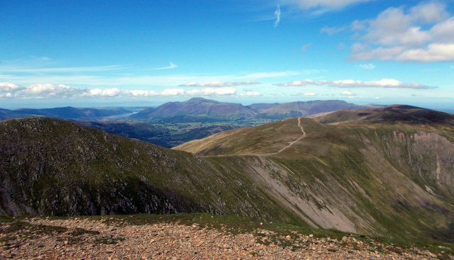
Thirlmere reservoir and distant Skiddaw in the North from just before where we leave the main path
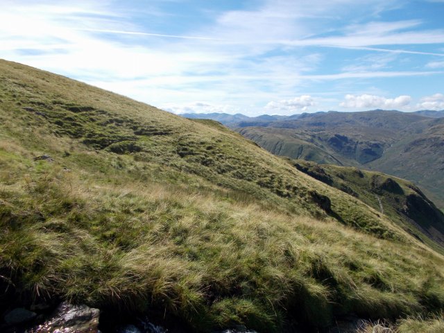
Looking back towards Coniston from the early part of the old shepherds’ path
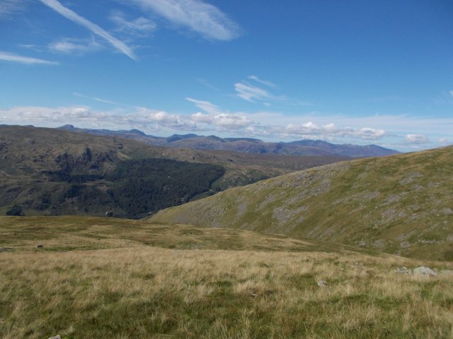
Looking towards the western Lakes with Great Gable Pillar and the Buttermere Fells prominent from the old shepherds’ path

The first views over to the eastern side of the range with Striding Edge on the right
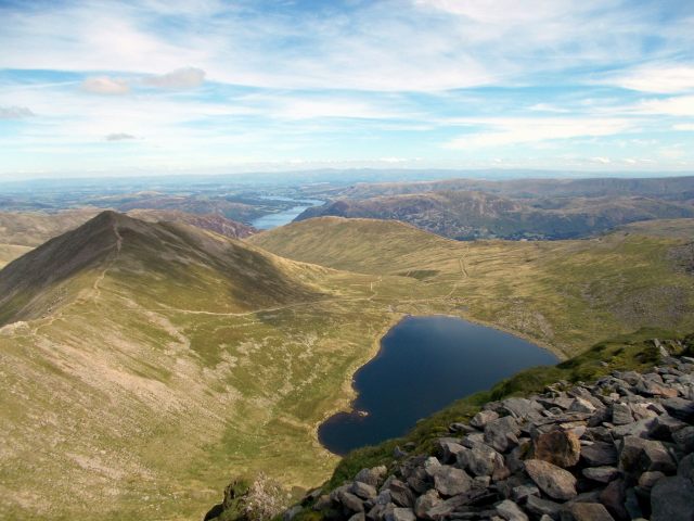
The eastern side of Helvellyn from the summit with Catstycam and Red Tarn close by. Ullswater is the more distant lake
Beautiful views north along the ridge towards Skiddaw and Blencathra from just past the summit

The steep eastern face of Helvellyn with walkers by the trig point

Not a bad spot for lunch before heading down – looking south along the ridge with Coniston in the far distance


You had beautiful weather for this walk, Pete
LikeLike
The Lakes is a good as anywhere when the sun shines!
LikeLike
Great pics Pete
LikeLike
Thanks – it was a good day out that one!
LikeLike
What scenery! Happy New Year!
LikeLike